Weather History: December 31st
Local and Regional Events:
2010: An area of low pressure moved across the Northern Plains on New Year’s Eve bringing widespread heavy snowfall along with blizzard conditions. Bitter cold northwest winds of 25 to 40 mph combined with additional snowfall of 6 to 10 inches brought reduced visibility to near zero across much of the region. This storm was the second blizzard in two days across the area. The blizzard conditions continued into early New Year’s Day. Both Interstates 29 and 90 were closed from the 31st until Sunday, January 2nd. There were several stranded motorists along Highway 83 with five people being rescued. The total snowfall amounts from the two storms ranged from 6 to 15 inches across the region.

The two-day snowfall amounts included 6 inches at Eagle Butte; 7 inches at Doland; 8 inches at Mobridge and Gann Valley; 9 inches at Castlewood; 10 inches at Murdo, Clark, Ipswich, Kennebec, and Watertown and 11 inches at Clear Lake and Bryant. Locations with a foot or more of snow included 12 inches at Aberdeen, Gettysburg, Highmore, Milbank, Mission Ridge, and Bowdle; 13 inches at Eureka, Pierre, Onida, and Blunt; 14 inches at Mellette, Sisseton, Victor, and Roscoe with 15 inches at Britton, Webster, and Redfield. The snowfall began between 6 am and noon CST on the 31st and ended between 4 am and 11 am CST on January 1st.
USA and World Events for December 31st:
1876: A heavy snow storm hit southern Arkansas, with amounts well over 20 inches in places. 28 inches was reported near Warren, and 24–28 inches was reported at Arkansas City.
1882: Downtown San Francisco saw 3.5 inches of snow.

1890: According to the National Meteorological Library and Archive from the United Kingdom, during December 1890, Westminster, England saw zero hours of sunshine. Click HERE to read a pdf with more Weather Extremes from the National Meteorological Library and Archive.
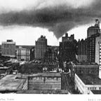
1933: During the last week of December, a series of winter storms pounded the mountainside with 12 inches of rain near Los Angeles. More rain occurred on New Year’s Eve, including 4.86 inches in downtown Los Angeles. The 4.86 inches is currently the fourth most rainfall to occur in one day in downtown Los Angeles since 1877. Around midnight, hillsides in at least three mountain locations collapsed sending millions of tons of mud and debris into the Crescenta Valley neighborhoods below. Crescenta Valley is a few miles north of Los Angeles. This mudslide destroyed more than 400 homes. Following the disaster, the U.S. Army Corps of Engineers and the County of Los Angeles built a flood control system of catch basins and concrete storm drains, designed to prevent a repeat of the 1934 disaster. The Historical Society of the Crescenta Valley has a few “Then and Now” photos from this event.

1967: The kickoff temperature for the NFL Championship Game between the Dallas Cowboys and the Green Bay Packers was -13°F with a wind chill of -36°F. This game is known as the “Ice Bowl.”
2000: The “Snow Bowl” was played between Mississippi St and Texas A&M at Independence Stadium in Shreveport, Louisiana. Snow began about a half hour before kickoff and didn’t stop until well after the bowl game.